The ZL8X DXpedition : 19 Nov.- 06 Dec. 2010 ß Back ß
This has been, as usual, a great low-band DXpedition by Dietmar DL3DXX and the well experienced German Team! In 17 days they made 148.750 QSO’s , with 4.225 of them on 160 meters. All the story, statistical data and pictures can be found on their website ZL8X Kermadec Island 2010 :: Home
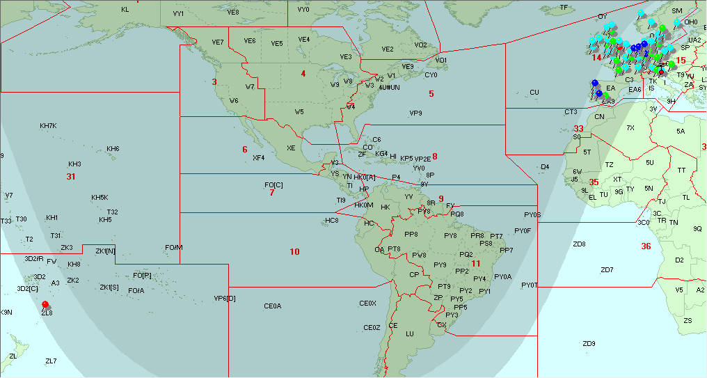
The path length to ZL8X ( on Raoul is., in the Kermadec Group) is 17.900 km. at 31 degrees, not an easy one from my QTH, and during the first 10 days of operation I never heard a peep, while whole Europe, north and south of me, was working them. Suddenly ZL8X jumped out of the noise on November 29 for half an hour, but the following days they have been peaking 579 for long time, really amazing ! …could have been steady ducting propagation conditions for so long time?
But even more amazing has been the discovery from the ZL8X logs -Tnx Dietmar DL3DXX – of 105 QSOs with Europe over the LONG PATH. Not only all the G’s and most western EU, but also 4 Italian stations managed to work them between 06.37 to 06.48z. There have been seven openings between Nov.21 and Dec. 02, around ZL8 SS and EU SR, and probably the path was along the Terminator, thus demonstrating that “on 160m Gray Line over Long Path can be very efficient” .
From their website statistics and final logs I built the following graphs showing the 160 m. LP and SP QSO distribution among the European countries related to their all band total QSOs.
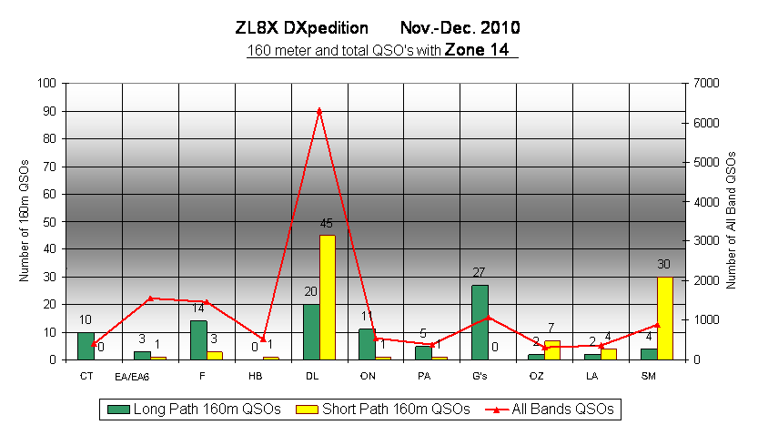

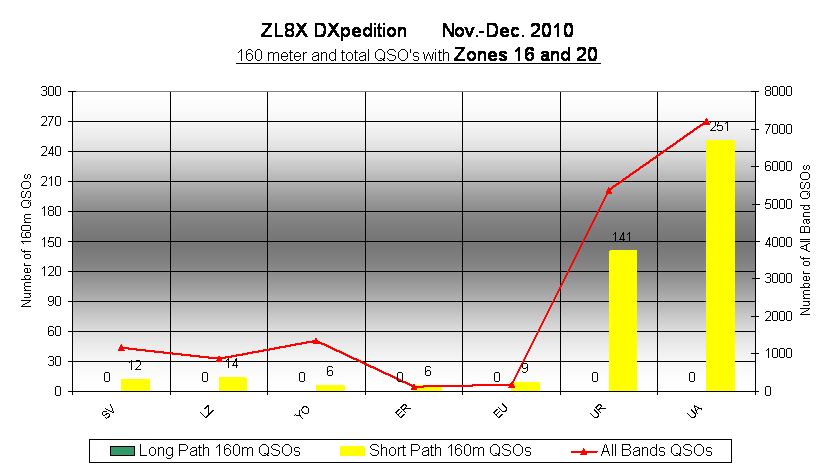
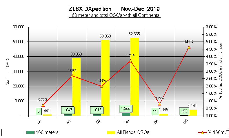
In total there are 1.013 QSO’s with Europe, and about 400 of them are with European Russia and Ukraine. The following graph shows the sums of all the continents.
From their final log I extracted all the European callsigns, matched with their own grid locator and filled the grid squares on the DX-Atlas map: bleu coloured are SP QSOs while the black squares have been worked via Long Path. I also added the coloured stick pins with the following code for the number of stations worked in that grid square : azure = 3 or more; green = 5 or more; blue = 7 or more; red = 10 or more. (I kept the same pin codes and scale to compare with the 3D2KJ map).
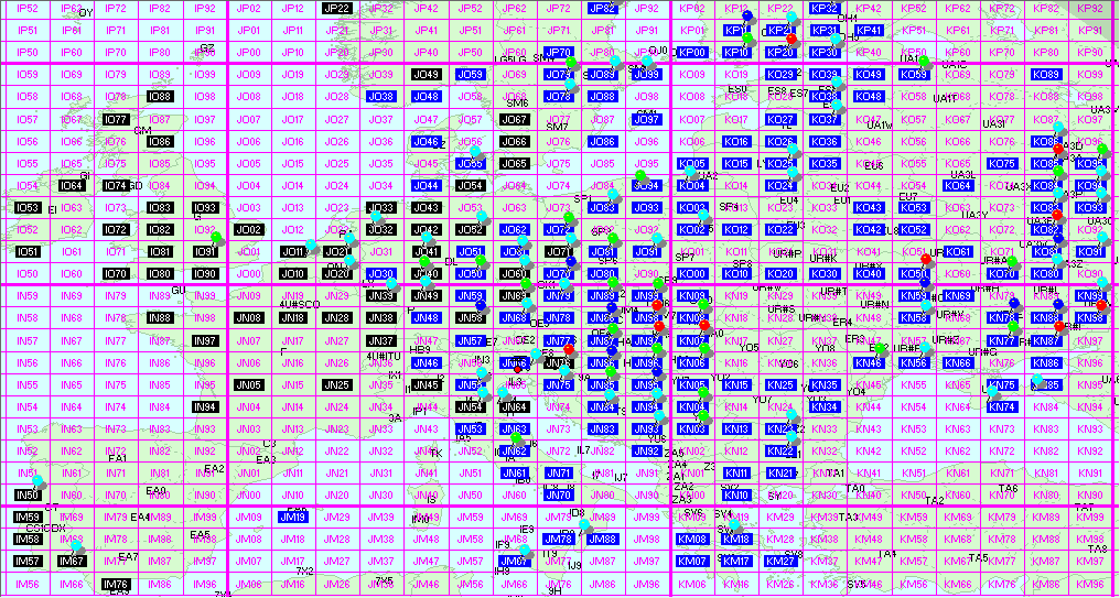
The following DX Atlas map, taken on Nov.29 at 06.30z, shows the Gray-Line long path between ZL8 and Western Europe, with pins on the worked squares.
DL3DXX e-mailed me the following further comments about their ZL8X Long-path achievement:
“Luis,
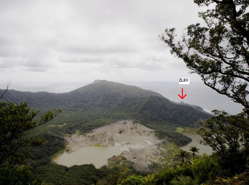
For your interest I tell you that more long path contacts would have been possible from a better location. Unfortunately no better location was available on Raoul island. We were pretty happy to find such good short path location, however long-path was behind the mountains.
You can see it on the attached picture. Our QTH was close to the group of Norfolk pine trees in the background. The picture is made from the hilltop as a view from the long path direction to the camp. 73 Dietmar”